Ancient Carthage
A stylistic depiction of ancient Carthage, designed for use in an educational Youtube video.
Client:Para Bellum
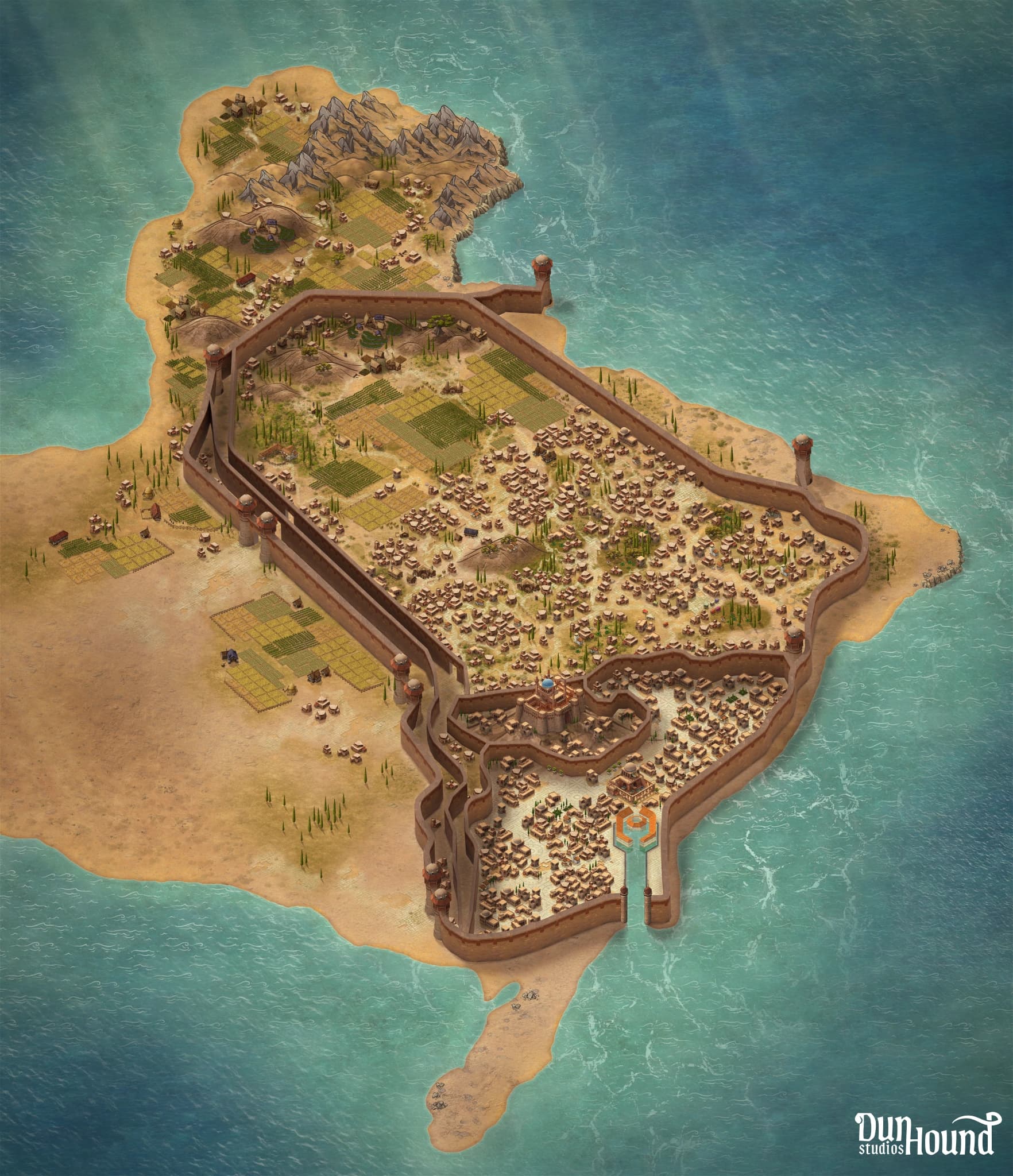
For this project, we collaborated with the historical YouTube channel Para Bellum to create a series of detailed perspective maps for an upcoming documentary on the Roman Siege of Carthage.
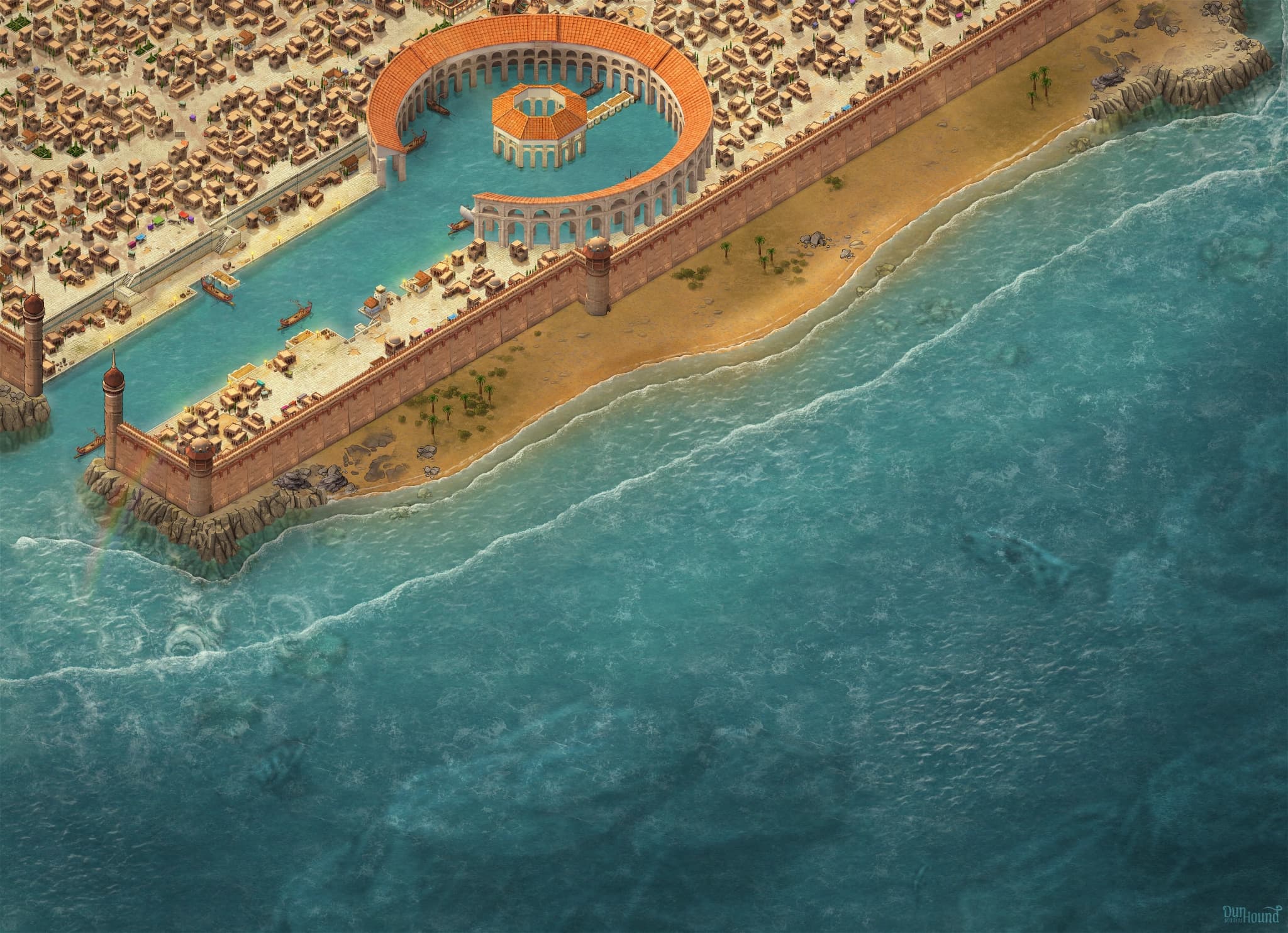
The client approached us with a specific pain point: they were dissatisfied with the visual style and technical execution of maps provided by a previous creator. The challenge was to produce two high-quality, historically accurate environments. A wide view of the entire city and its surrounding semi-desert terrain, and a dedicated close-up of the famous circular harbor, designed specifically for isometric battle animations.
This required a rigorous revision process to ensure the density of the "Lower City" and the placement of the triple walls aligned with historical research, to maintain the authenticity of the ancient setting.
To solve the technical limitations of standard map-making tools, which often produce jagged walls at fixed, pre-created angles, we designed a bespoke set of city walls in Blender and imported them as custom assets. This allowed for smooth, organic lines that perfectly traced the unique geography of the Carthaginian peninsula. Throughout the project, I worked closely with the client to calibrate the scale and height of the fortifications and the specific perspective of the harbor to accommodate their animation needs, such as showing Roman troop landings and naval maneuvers.
The final delivery provided the client with a professional, cohesive visual style that bridged the gap between artistic illustration and educational accuracy, leading to a successful project completion and a continued partnership for future historical modules.